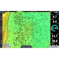

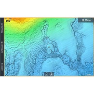
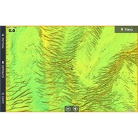
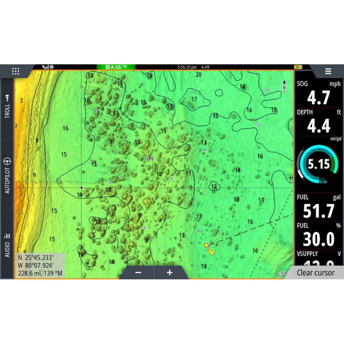
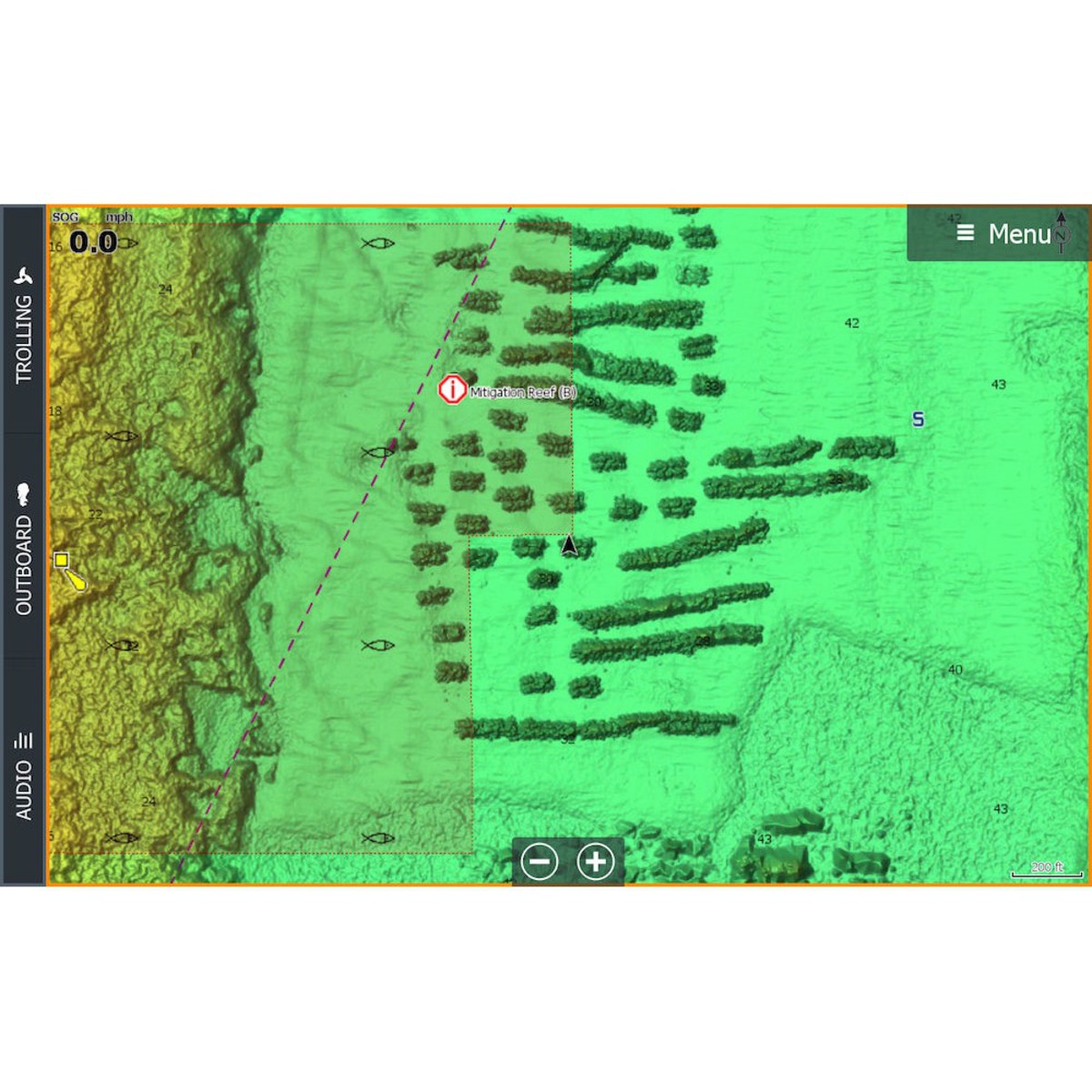
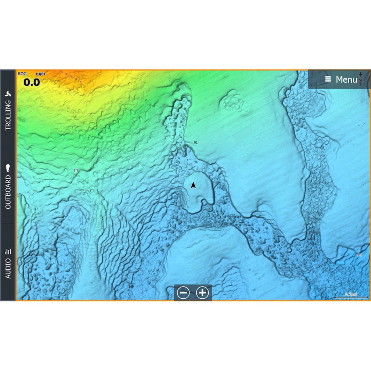

C-MAP® Reveal charts help anglers and divers save time on the water, finding key areas faster with the high-definition views of structure, wrecks and contour changes on the sea floor.
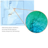
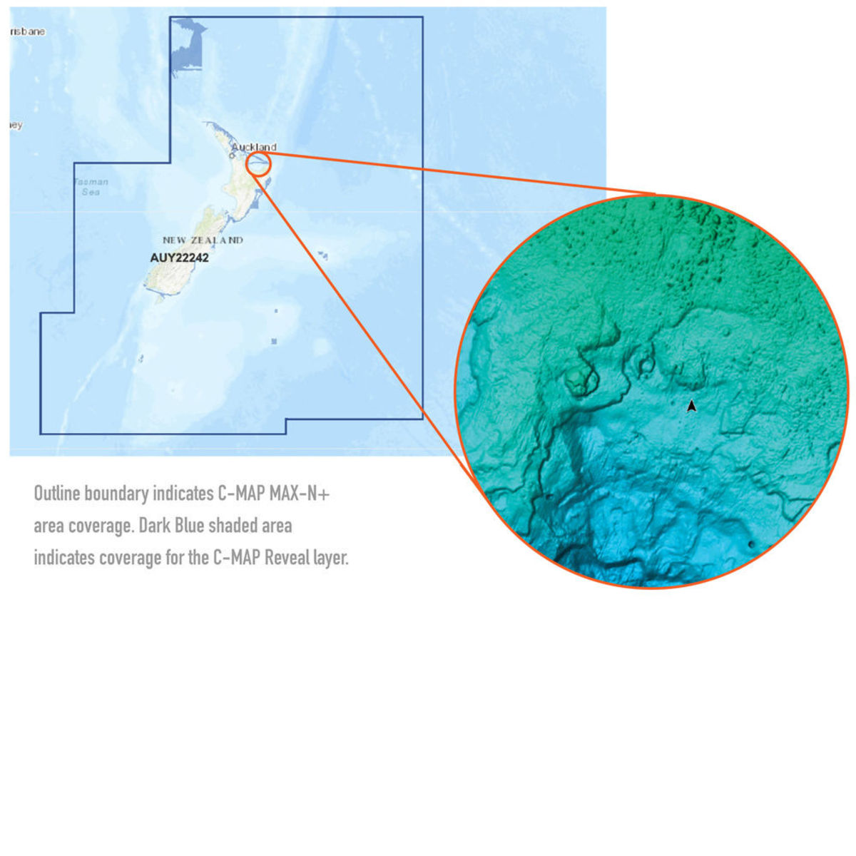
The high-detail C-MAP® Reveal imagery replaces shaded relief data in selected areas with more accurate depth variations, revealing the best fishing and diving spots. C-MAP Reveal charts include C-MAP HRB Coastal Data, Genesis social map data and satellite imagery that can be overlaid on top of the standard vector charts used for navigation. The C-MAP Reveal layer is activated by turning on the Shaded Relief setting and is available for use on these compatible chartplotters:
Simrad:
- Simrad GO
- Simrad NSS EVO2
- Simrad NSS EVO3
- Simrad NSS EVO3S
Lowrance:
- Lowrance Elite Ti
- Lowrance Elite Ti2
- Lowrance Gen2
- Lowrance Gen3
- Lowrance Carbon
- Lowrance Live
Features
- High-definition C-MAP Reveal layer of the sea bottom on selected areas
- Reduces search time with immediate display of bottom structure, wrecks, isolated reefs and ledges
- Easy to use – just turn on Shaded Relief setting in chartplotter
- C-MAP Reveal charts contain full C-MAP MAX-N+ vector navigation data, including new features like High Resolution Bathy
- Custom Depth Shading, Genesis layer and satellite imagery
- Includes detailed marina and port plans
- Most affordable sea bottom charts available
- Loaded on Micro SD Card
Smart VIP Price Promise
Our prices are very Smart at Smart Marine! Our Smart VIP Membership and committment to great deals makes sure of that, but if you find a lower price, tell us- we will match it!*
Price Promise Terms & Conditions
- Excludes limited time specials, clearances, non-stocked products, overseas websites, price comparison websites and eBay/TradeMe.
- Applies to identical products, in stock in NZ with pricing valid at time of price match request and purchase, with evidence supplied.
- Excluded Products: clearance, run-out, distress, damaged/soiled, parallel imported, non-stocks, trade quotes, commercial quantities, credit account holders, insurance claims, services, typos, overseas websites, price comparison websites, auction websites.
- Free product, offers, sales and promotions cannot be redeemed with price matches.
- The price match applies to the total cost to buy including shipping, taxes and fees.
- Approved Price Promise Matches and purchases can only be redeemed with our store crew. Please contact your closest store with stock.
- Short term finance may not be available with some price matched purchases. Please enquire.
.jpg)